Cap de Creus Natural Park: Hiking, Swimming, and What to Know Before You Go
Cap de Creus is the Costa Brava at its most elemental. This guide covers the hiking trails, swimming coves, and marine reserve of the park in full, with the practical intelligence and landscape context that a considered visit to the northernmost headland of Catalonia requires.
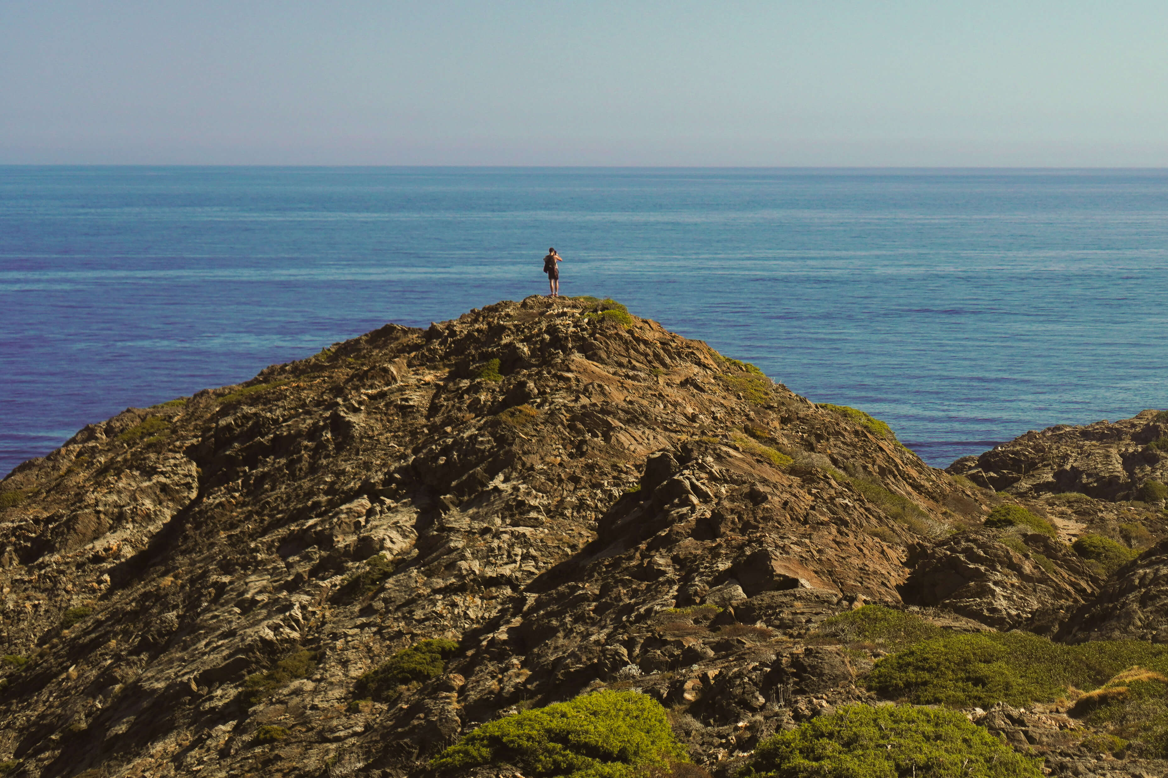
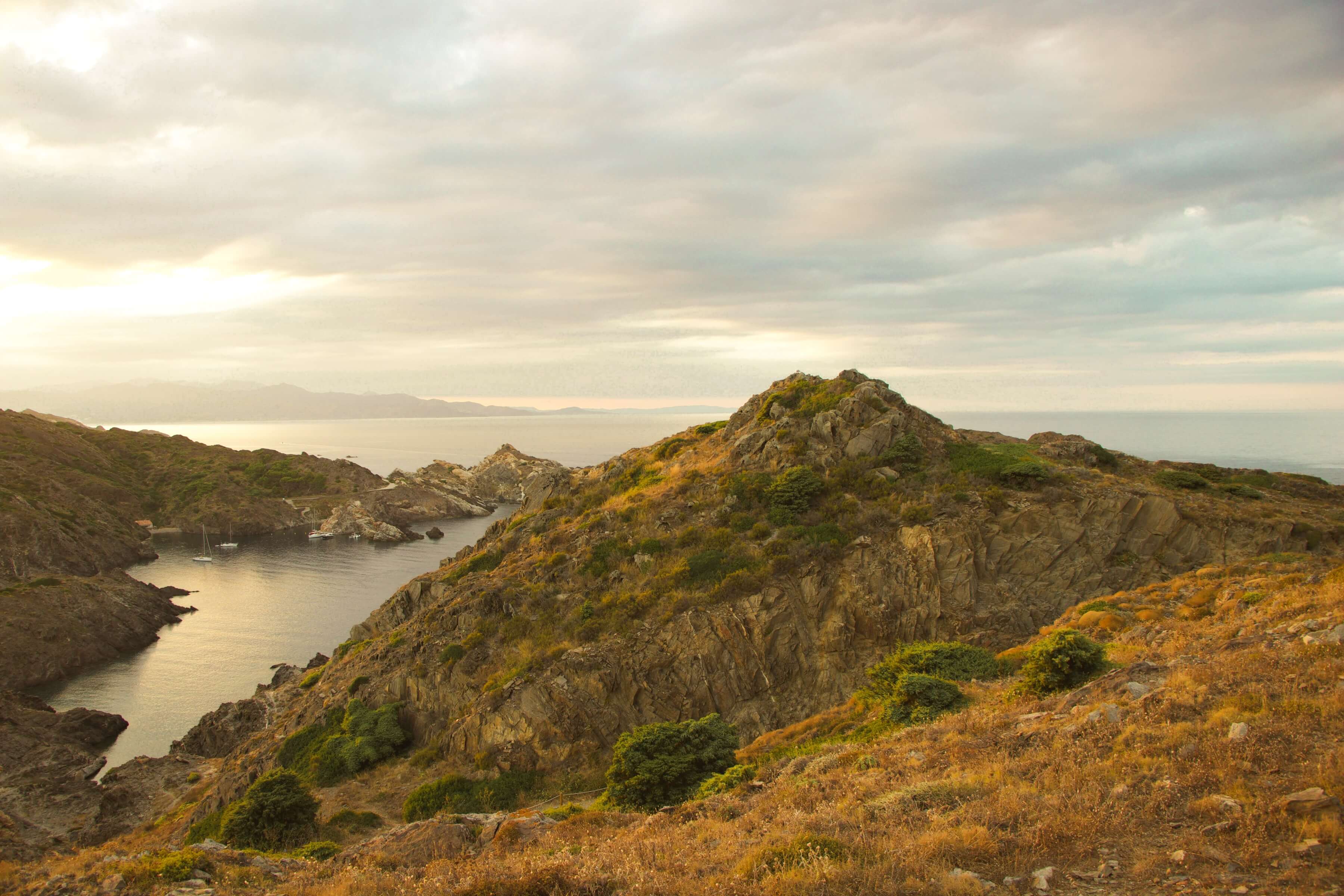
Cap de Creus does not look like the rest of the Costa Brava. The headland that forms the easternmost point of the Iberian Peninsula has a quality of exposure and austerity that sets it apart from the more sheltered coves of the central coast. The tramuntana has shaped this landscape for millennia, rounding the schist formations into low, worn curves, stripping the vegetation back to scrub and wild rosemary, and producing a coastline that feels genuinely remote even when Cadaqués is forty minutes away on foot.
That remoteness is the point. Cap de Creus is the Costa Brava at its most elemental, and it rewards the traveler who arrives prepared to engage with it on its own terms.
What Cap de Creus Actually Is
The easternmost point of the Iberian Peninsula
Cap de Creus Natural Park is the point where the Pyrenean chain meets the Mediterranean, and the geology here reflects that collision directly. The headland is composed of schist and granite shaped over hundreds of millions of years, and the tramuntana has done the rest. The result is a landscape unlike anything else on the Costa Brava: lunar in places, dramatic in others, and consistently beautiful in a way that has nothing to do with the manicured pleasures of a beach resort.
The natural park covers approximately 14,000 hectares of land and a further 3,000 hectares of marine reserve, making it one of the most significant protected areas in Catalonia. Its protected status has preserved a quality of wildness that is increasingly rare on the Mediterranean coast.
Why the landscape looks the way it does
The tramuntana is the defining force of this landscape. The wind arrives from the north with enough consistency and force to prevent most tree growth above a certain elevation, keeping the headland open and exposed in a way that amplifies every view. The same wind that makes a winter day here genuinely inhospitable produces, in summer, a clarity of light and air that painters and photographers have been drawn to for over a century. Dalí, who lived in Portlligat a short walk from Cadaqués, described the landscape of Cap de Creus as the most concrete and objective geological delirium imaginable. The description holds.
Hiking Cap de Creus
The Camí de Ronda: the coastal path worth knowing
The Camí de Ronda is the old coastal path that runs the length of the Costa Brava, originally used by customs officers monitoring the coastline. On the Cap de Creus peninsula, it becomes something closer to a wilderness trail: narrow, rocky, and frequently spectacular. The sections north of Cadaqués toward the lighthouse at Far de Cap de Creus and south toward Cala Montjoi offer the best walking on the northern Costa Brava, and arguably the best on the entire coast.
The path requires good footwear and a reasonable level of fitness. The terrain is uneven and the sun exposure in summer is significant. Carrying water and starting early in the morning, before the heat builds and the light flattens, is the most practical approach.
The walk to the lighthouse
The lighthouse at Far de Cap de Creus sits at the tip of the headland and is reachable by road as well as on foot. The walking route from Cadaqués takes approximately two hours at a comfortable pace, following the Camí de Ronda north along a coastline that becomes progressively wilder and less visited. The lighthouse itself is a functional building with a restaurant that operates in summer and views that extend on a clear day to the Pyrenees in the north and the Medes Islands to the south.
The return to Cadaqués can follow the same coastal path or take the inland track through the park, which offers a different perspective on the schist landscape and a slightly easier surface underfoot.
Trails from Cadaqués north and south
The trail network around Cadaqués divides into two natural directions. North toward the lighthouse and Cap de Creus is the more dramatic option, with the wilder coastline and the most remote coves. South toward Cala Montjoi and the Gulf of Roses is longer and less frequently walked, passing through landscape that feels entirely untouched and reaching swimming spots accessible only on foot.
For walkers with a full day, combining a morning walk north to the lighthouse with an afternoon return via the southern path creates a complete circuit of the headland's most significant terrain. This is a long day and requires honest assessment of fitness and heat tolerance in summer.
Swimming in Cap de Creus
The coves accessible on foot
The coves of Cap de Creus are among the most beautiful swimming spots on the Mediterranean coast, and many of them are accessible only on foot or by boat. That inaccessibility is precisely what preserves their quality. Cala Culip, north of Cadaqués on the Camí de Ronda, is sheltered and clear with the kind of water that makes a swim feel like a reward rather than a convenience. Cala Fredosa and Cala Jugadora, further north toward the lighthouse, are smaller and more exposed but offer a quality of solitude in summer that the more accessible beaches cannot match.
South of Cadaqués, Cala Guillola is reachable after about forty minutes of walking and is rarely crowded even at the height of summer. The town beach in Cadaqués, Es Pianc, is the most accessible option and suits those who want easy proximity to cafés and shade.
What the water is actually like
The water around Cap de Creus benefits directly from its protected status. The marine reserve has prevented the kind of boat traffic and anchor damage that affects water quality on more accessible stretches of the Mediterranean, and the visibility here is among the best on the Costa Brava. In summer, water temperature typically reaches 24 to 26 degrees Celsius, and the clarity is good enough to see the bottom clearly in several meters of water.
The tramuntana affects swimming conditions when it arrives. The exposed coves on the northern and eastern sides of the headland become uncomfortable in strong wind, while the more sheltered coves south of Cadaqués remain calm. Checking conditions before planning a cove walk saves a significant amount of effort.
Water Activities in the Marine Reserve
The protected marine reserve around Cap de Creus offers some of the most rewarding snorkeling and diving on the Costa Brava. The sea floor is varied and largely undisturbed, with posidonia meadows, rocky reef systems, and marine life that reflects decades of protection. For snorkelers, the shallow rocky areas around sheltered coves offer clear visibility and accessible depth. Kayaking around the Cap de Creus headland on a calm day is one of the defining experiences of this coast, offering a perspective from the water that is entirely different from anything available on foot. Operators in Cadaqués offer guided kayak trips and equipment rental for those planning their own route.
When to Go and How Long to Allow
June and September are the most intelligent months for Cap de Creus. The heat is manageable for hiking, the water is warm enough for extended swimming, and the park has not yet reached the visitor volumes of July and August. Early morning starts in any summer month make the trails significantly more comfortable and the coves significantly less crowded.
A half day covers the lighthouse walk and a swim at one or two coves. A full day allows for a more complete circuit of the headland. For travelers based in Cadaqués for three nights or more, spreading the park across two separate outings, one focused on hiking and one on swimming and water activities, is the most satisfying approach.
Practical Notes for Visiting Cap de Creus
The park has no entrance fee and no booking requirement for the trails. The lighthouse restaurant operates in summer and is a practical lunch option for those completing the walk to the cape. Water and sun protection are essential for any trail in summer. Mobile signal is inconsistent on the more remote sections of the Camí de Ronda, and downloaded offline maps are worth having before leaving Cadaqués.
The road to the lighthouse is open to cars in summer, which means the cape is reachable without walking. For those with limited mobility or time, this is a practical option that delivers the views without the physical commitment of the trail. Parking at the lighthouse fills in summer mornings and is more reliable early in the day or after five in the afternoon.
Cap de Creus sits within easy reach of Cadaqués, which is covered in full in our guide to slow travel on the Costa Brava. For those approaching the park as part of a wider journey, our guide to driving the Costa Brava covers the routing from Barcelona north and how the park fits into a complete Catalonia itinerary.
Cap de Creus is not a park that reveals itself on a single visit. The light changes with the season and the hour. The coves that are crowded in August are entirely your own in September. The trails that feel demanding in the midday heat become effortless in the early morning. It is a landscape that rewards return, and that rewards the traveler who approaches it with enough time and enough patience to let it give what it has to offer.
FAQs
How do you get to Cap de Creus?
The park is most easily reached by car from Cadaqués, approximately ten minutes from the lighthouse by road. The Camí de Ronda from Cadaqués reaches the lighthouse on foot in around two hours. There is no public transport to the interior of the park.
Is Cap de Creus suitable for non-hikers?
What is the best cove for swimming in Cap de Creus?
Is the Cap de Creus marine reserve open for snorkeling and diving?
Is Cap de Creus suitable for families or older travelers?
How does the tramuntana affect a visit to Cap de Creus?
Plan Your Cap de Creus Visit
Cap de Creus rewards careful planning and enough time to explore it properly. Contact us to discuss how we build the park into a wider Costa Brava or Catalonia journey.
Latest posts

The 2030 World Cup is coming to Spain, Portugal, and Morocco
In 2030 the World Cup comes to Spain, Portugal, and Morocco. Our travel coordinator Pedro Contreras Gonzalez, who has spent over twenty years in hospitality across Spain and the UK, on what has been confirmed, what has not, and what it means for anyone thinking about being there.
Read more

How to design a week in northern Morocco around the 2027 solar eclipse
A week in northern Morocco built around the 2027 solar eclipse combines Tangier, the blue city of Chefchaouen, and Tetouan's UNESCO medina for eclipse day, where four minutes and fifty-three seconds of totality will descend on one of the most culturally extraordinary cities in North Africa.
Read more

How to design a week in Andalusia around the 2027 solar eclipse
A week in Andalusia built around the 2027 solar eclipse covers Seville, Ronda, the Sierra de Grazalema, and Marbella for eclipse day, with enough time to experience one of the great destinations in southern Europe alongside one of the most extraordinary astronomical events of a lifetime.
Read more